


Next meeting scheduled for January 8, 2026
Please note, our next scheduled meeting is January 8th, 2026.

Holiday Office Hours
Please view our Holiday Office Hours Here

Next Council Meeting
Meetings are held the first Thursday of the month at 9:00 AM. The next council meeting is Thursday, December 4th Read More …

2025 Winter Holiday Newsletter
2025 Winter Holiday Newsletter Read The Newsletter Here
SkPower Vegetation Management
SkPower Vegetation Management information on Consulting Utility Forester for CNUC of Canada. Read More

Plant Health Newsletter Fall 2025
The Plant Health Network Fall Newsletter is now available. Read it here


Plant Health Newsletter Summer 2025
Read More
Channel Clearing & Drainage Project
Continue Reading

Sask Power Info Sheets
Biosecurity-and-Power-Lines-Info-Sheet Information Sheet – 2025 Wood Pole Maintenance Program
About & History
Picture from Wikipedia.org
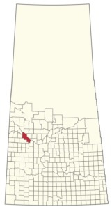
The RM of Battle River No 438 is situated in north-west central Saskatchewan. The RM borders the urban municipality of Battleford on the North Saskatchewan and Battle Rivers. The North Saskatchewan River serves as the north boundary for some 50 km. The Battle River traverses the RM from NW to SE and ends in the North Saskatchewan River just east of Battleford. The west borders the RM of Payton (#470) and the Sweetgrass First Nation. The south borders the RM of Buffalo (#409) and Glenside (#377) to the south and east.
The RM is at the hub of the Battlefords with 4 major highways running through. The TransCanada Highway #16 NW, highway #40 west, highway #29 southwest, and #4 south. There is also a CTP (Clearing The Path) corridor running from highway #16 through the hamlet of Prongua to highway #29.